Contents
Share
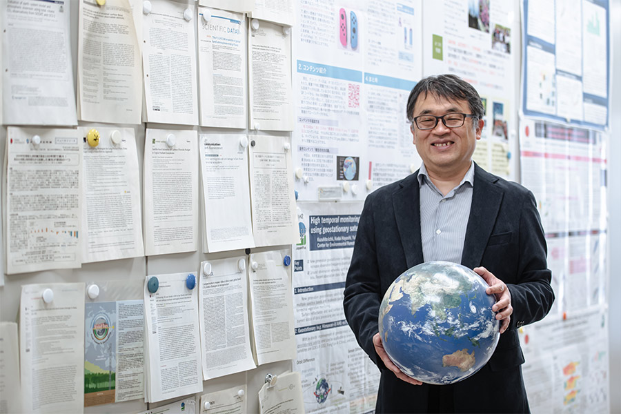
Accurate monitoring of carbon dioxide (CO2), a greenhouse gas, on a global scale is essential to achieve carbon neutrality. However, quantifying the amount of CO2 absorbed and released by plants through processes such as photosynthesis and respiration, in contrast to the CO2 emissions resulting from human activities, is challenging due to various influencing factors. We interviewed Professor Kazuhito Ichii of Chiba University’s Center for Environmental Remote Sensing about his unique research, which utilizes data and numerous models collected around the world to calculate changes in CO2 absorption and emission by terrestrial ecosystems.
To provide a better estimate of the CO2 balance
Please tell us about your current research
My main research focuses on two areas: “Land Monitoring using Geostationary Meteorological Satellites” and “Estimation of CO2 Balance in Land Areas.” I conduct observations of land areas on Earth, including vegetation distribution and changes, using data from geostationary meteorological satellites worldwide, such as the Himawari-8 satellite, commonly used for weather forecasting. This innovative use of satellite data aims to achieve highly accurate estimation and prediction of the CO2 balance in land areas. Additionally, I integrate various other observational data to further improve the CO2 budget estimation in terrestrial environments.
How does your research contribute to carbon neutrality?
For achieving carbon neutrality as a climate change mitigation measure, it is particularly crucial to predict the future concentration of CO2 in the atmosphere. It is known that 40% of the CO2 emitted from using fossil fuels remains in the atmosphere, 30% is absorbed by terrestrial ecosystems, and 30% is absorbed by the oceans. As land encompasses diverse climates, such as tropical, tundra, and desert, and is also influenced by human activities, the CO2 balance varies significantly across different regions. Therefore, my research focuses on estimating the CO2 absorption balance in land areas.
Accurate estimation of the terrestrial CO2 balance would enable us to forecast, for example, the efficiency changes resulting from afforestation. Such “better estimates” are essential for carbon neutrality, and I would like to generate fundamental data to support this objective. Accurate estimation of the terrestrial CO2 balance would enable us to forecast, for example, the efficiency changes resulting from afforestation. Such “better estimates” are essential for carbon neutrality, and I would like to generate fundamental data to support this objective.
How do you estimate the terrestrial CO2 balance?
We employ four methods for estimation. The first is to collect in-situ observation data. The second is remote sensing, which involves collecting extensive data from satellites. The third method is to construct numerical models on a computer. The fourth method is an inverse calculation based on atmospheric CO2 concentration measurements. By combining these four approaches, I aim to achieve highly accurate estimations.
In my research, we can estimate the land CO2 balance at a resolution of 1 km2 using these four methods. The implementation of carbon-neutral practices will likely occur at the national and regional levels. My research, which used to focus on global environmental issues, has recently evolved to contribute to problem-solving at the national and regional scales.
Global monitoring by integrating useful data
When did you become interested in remote sensing?
During my high school years, I had a keen interest in seismology, which led me to major in earth science at university. After graduating, I worked as a software engineer at a company where I was first introduced to the concept of “remote sensing,” the Earth observation from space. I was impressed by the state-of-art technology to observe large areas from space.
Upon entering graduate school to pursue advanced research in earth observation using remote sensing, I had the opportunity to collect over ten years’ worth of global-scale Earth observation data observed from space. It was during this time that I came across a significant research paper that discovered a shift of approximately one week in the timing of leaf flushing in spring as a result of the impact of global warming. I was truly impressed by the ability to comprehend the effects of climate change on a global scale through the long-term observation data from space, and it was this sense of wonder that drove me to pursue a career in this field.
Could you tell us more about the features of land monitoring using geostationary meteorological satellites?
Previously, Earth observation satellite data have long been used for global monitoring of terrestrial ecosystems. While these satellites can observe the entire globe, each region is typically observed only once a day. This limitation has resulted in large missing data, particularly in areas frequently covered by clouds, and there has been a demand for more frequent observations.
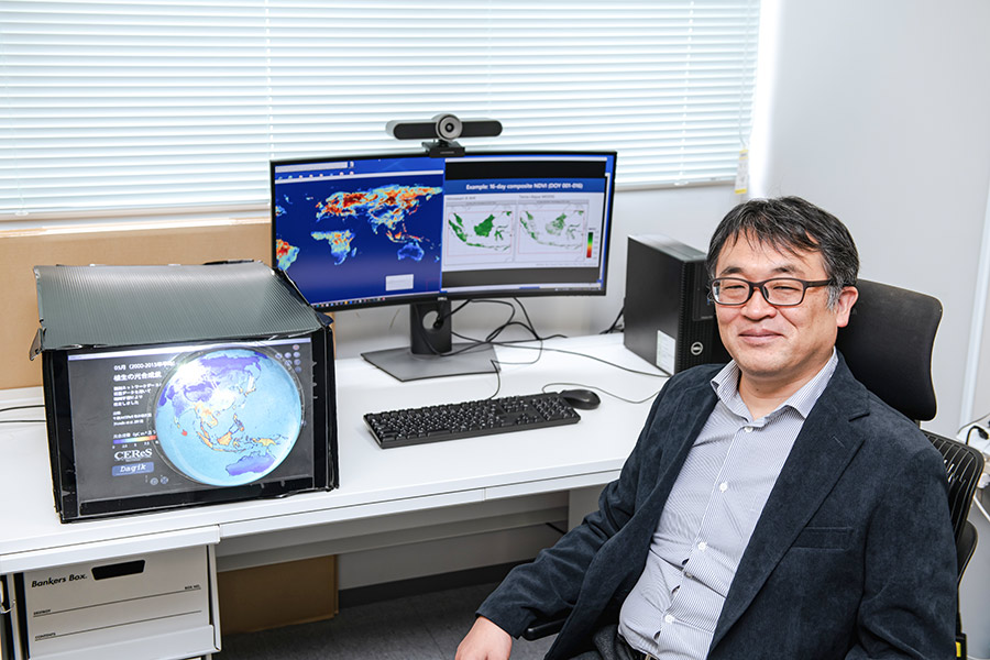
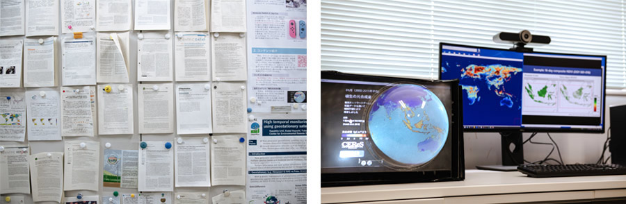
Therefore, I directed my attention to data from the Geostationary Meteorological Satellite “Himawari” that the Center for Environmental Remote Sensing had archived. Himawari, which are always located in the same spot when viewed from the ground, offers the remarkable capability of capturing the entire hemisphere centered on the Asia-Oceania region at ten-minute intervals. While traditionally used for monitoring cloud dynamics, I realized that with the significantly improved performance of the latest geostationary meteorological satellite data, I could apply it to observe processes such as photosynthesis and plant growth. This idea led me to believe that we could gain a more detailed understanding of land vegetation. Consequently, I incorporated this data into my ongoing research.
How do you estimate the land CO2 balance using geostationary meteorological satellites, which do not have the capability to directly measure CO2 concentrations?
Satellite observation can measure the intensity of reflected light when sunlight interacts with plants as well as the surface temperature of the ground. These data are then incorporated into a numerical model to calculate photosynthesis and estimate the land CO2 balance. Our center possesses extensive expertise in processing geostationary meteorological satellite data over more than 20 years, which gives it a strength not found in other institutes.
What do you think are your own strengths and uniqueness?
“Utilize all available resources,” I excel at drawing conclusions by integrating data collected from around the world. While I don’t conduct in-situ observations, I leverage my strength in making the most of available resources. Rather than focusing solely on a specific area and approach, such as observation or remote sensing, I combine different methodologies to construct a comprehensive understanding.
To achieve this, collaboration among researchers from various countries and fields is essential. It is fascinating how attending international conferences and research symposiums allows me to expand my network and make new connections in the research community.
Achieving carbon neutrality requires the power of companies
There must be many joint projects internationally and at home
I have a strong curiosity about current global issues. In 2022, my research project titled “International Research Network for Hyper-temporal Monitoring of Terrestrial Environment using Multiple Geostationary Satellites” was selected by the “Core-to-Core Program” of the Japan Society for the Promotion of Science. As part of this project, I established “GEOLAND-NET,” an international hub for land monitoring. While the Himawari geostationary meteorological satellite provides exceptional coverage for the Asia-Oceania hemisphere, its scope is limited. However, by combining geostationary meteorological satellite data from Japan, China, South Korea, the United States, and Europe, we can achieve global-scale land monitoring and potentially uncover intriguing insights.
This comprehensive network holds the potential to facilitate rapid monitoring of agricultural crop conditions and real-time detection of vegetation changes, particularly during large-scale forest fires, through a global network. We have high expectations for our ability to monitor and understand new dynamics in the Earth’s surface environment.
In 2021, the “University Coalition for Carbon Neutrality” was established as a platform for domestic universities to exchange and disseminate information regarding carbon neutrality. Chiba University has actively contributed to this coalition, with several researchers, including myself, being involved. Specifically, I am part of the Next Generation Development Working Group along with Associate Professor Akira Kato from the Graduate School of Horticulture. Our group focuses on fostering talent and collaboration, which includes organizing study sessions in collaboration with Rikkyo University, led by Associate Professor Kato. Through these initiatives, we have received an offer from a company to engage in joint research on measuring carbon stocks in forests, and we are currently undertaking this project.
Since the Paris Agreement in 2015, climate change has been increasingly perceived as a pressing issue. Chiba University possesses a wealth of valuable information that can be effectively utilized for the current trending concept of Green Transformation (GX)*. While research at the university is conducted on a small scale within individual laboratories, I strongly believe that fostering dialogue between universities and companies is essential for the effective dissemination and implementation of our research findings.
*GX refers to the comprehensive transformation of the economic and social system aimed at achieving national targets such as carbon neutrality by 2050 and reducing greenhouse gas emissions by 2030. It recognizes these efforts as opportunities for economic growth, emission reduction, and enhanced industrial competitiveness.
Finally, please give a message to students who are interested in your research
Prioritize pursuing your passions rather than solely focusing on short-term outcomes. I also encourage students to explore how they can challenge themselves and leverage the research environment to foster personal growth. In the fields of global environmental studies and carbon neutrality, international collaboration is highly prevalent, offering you the opportunity to enrich your experiences and expand your horizons alongside fellow researchers from around the world.
Within this field, a wealth of observational data is being accumulated, resulting in the era of big data. However, we have yet to fully exploit the potential of this data, which is where the increasing integration of AI comes into play.
Engaging in discussion and collaborating with individuals worldwide to shape and pioneer new frontiers is truly fascinating. Embrace the challenges and possibilities that lie ahead, and I wish you success in your academic journey with our lab members.
Series
The Role of Universities to Achieve Carbon Neutrality
What role should universities play in realizing carbon neutrality by 2050? This series will explore this question, accompanied by research conducted at Chiba University.
-
#1
2023.06.22
Harnessing CO2 with a Photocatalyst for Fuel and Plastic Feedstocks: Advancing a Sustainable Society with Chemistry
-
#2
2023.06.29
Unlocking Untapped Urban Resources: Driving Carbon Neutrality through Life Cycle Assessment
-
#3
2023.07.04
Predicting Future CO2 Absorption and Emissions in Terrestrial Ecosystems: International Geostationary Meteorological Satellite Network for Accurate Estimation
-
#4
2023.07.12
The Global Goal of Carbon Neutrality by 2050 (Part 1): Universities as Agents of Change
-
#5
2023.07.14
The Global Goal of Carbon Neutrality by 2050 (Part 2): A decarbonized society from a local perspective
-
#6
2023.09.12
Reassessing the role of “Forest Resources” in achieving carbon neutrality: Measuring forests with the combination of drones, mathematics, and computer graphics
-
#7
2023.09.28
Navigating Offshore Wind Power Expansion: Nurturing Ocean-based Wind Energy Management Experts through Industry-Academia Partnership
Recommend
-
The role of the Research Institute of Disaster Medicine (RIDM): The indispensable research hub for urban digital transformation
2023.02.23
-
CUTICULA: A Secret of Unique Body Shape of Insects −Exploring the Sophisticated Mechanism Behind their Elongated and Round Bodies
2023.12.11
-

Understanding the Relationship between Diseases and Membrane Protein Structure
2022.07.26