Contents
Share
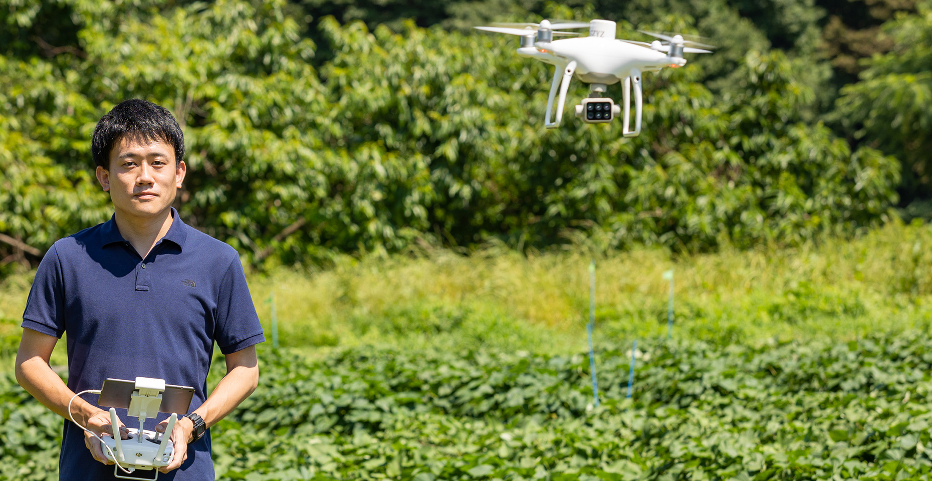
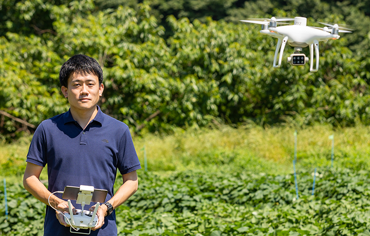
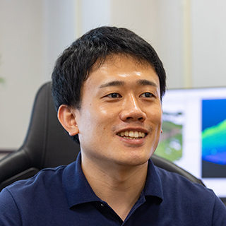
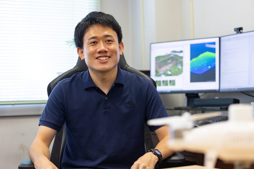
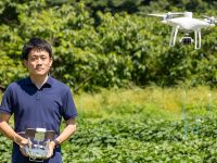
Did you know that drones and sensors are increasingly playing a major role in the field of agriculture? We interviewed Assistant Professor Akira Hama from the Graduate School of Horticulture at Chiba University, Japan, regarding emerging cutting-edge technologies that are tackling agricultural challenges every day. This article based on the interview is a must-read for gadget lovers!
Using data to visualize underground sweet potatoes hidden from sight
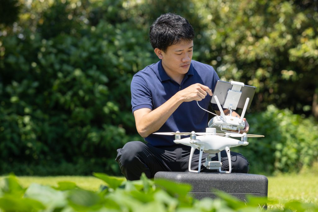
How are drones used in agriculture?
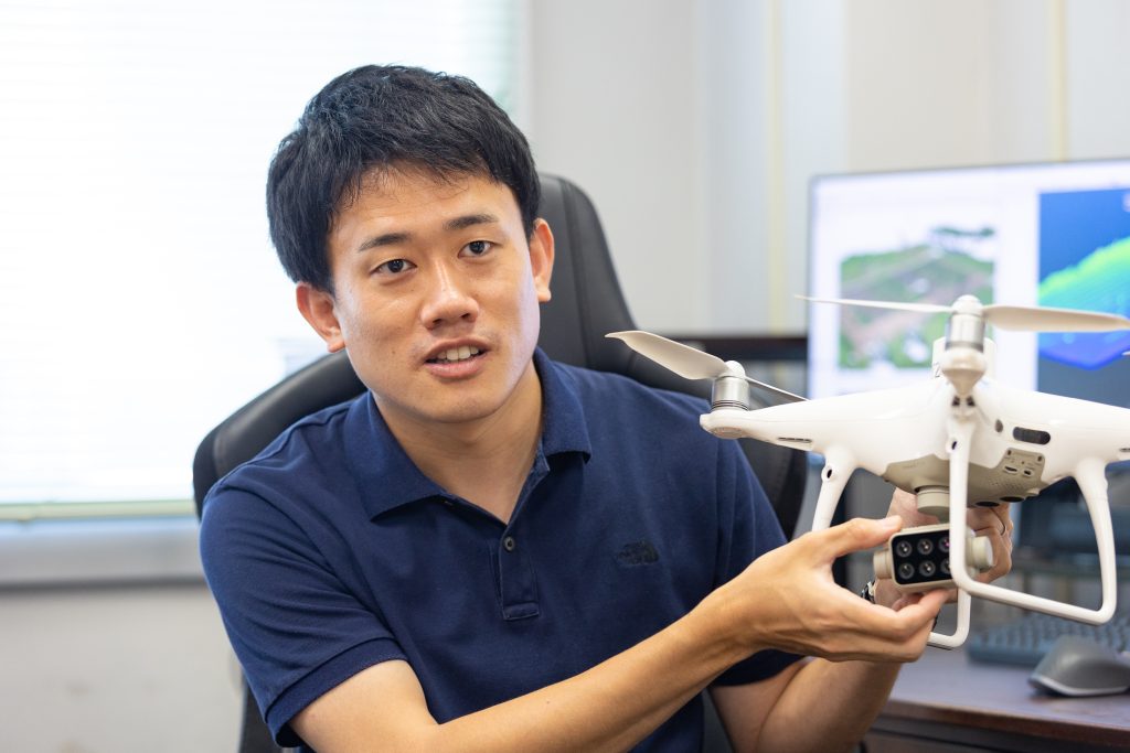
It has been reported that drones are generally used for direct applications, such as spraying pesticides on crops and sowing seeds. For my research, however, I am not using drones that conduct such tasks directly. Instead, with the help of the sensors on board, they take aerial images of the farm. The data obtained from these images are analyzed to extract information that can help improve the quality and yield of crops. In technical terms, such technology that obtains information using sensors, such as cameras without touching the subject/object of interest is known as “remote sensing.”
For example, I used a drone to photograph the leaves and stems of sweet potatoes throughout their growth process. These photographs were then analyzed to see if I could obtain information about the underground environment based on the visible portions of the leaves and stems.
This is especially helpful, because we cannot observe how sweet potatoes are growing unless they are dug up.
It was then found that there was a relationship between the state of growth of the stems and leaves and the state of sweet potatoes in the ground. By quantifying the number of above-ground leaves and the height of high-quality sweet potato plants, it is possible to determine the optimum growth conditions.
I believe that the intuitions and experiences of farmers could be turned into concrete and objective factors, which could give us useful information to develop smart agriculture technologies that incorporate new-age information and communication technology.
How did you analyze the relationship between the images taken by a drone and the quality of the sweet potatoes?
To be honest, I did not know the potential and scope of remote sensing before I started this research. For sweet potatoes, it is recommended to set the growth of the above-ground portion to be at a moderate level. But as we continued our analysis, our data led us to the rule of thumb that can help to grow high-quality sweet potatoes. Furthermore, sweet potatoes become sweeter and more delicious if they are stored for a while after harvest. Conversely, some sweet potatoes also rot during storage, which can lead to losses.
Thus, I analyzed the image data and the characteristics of sweet potatoes that were known for being rot-resistant. This way, the image data provided us with the possibility of identifying sweet potatoes with good storage properties. Once I can identify what is or isn’t suitable for storage, I can reduce large-scale losses of crops. This information is also important because sweet potatoes are one of the main crops grown and consumed in Chiba prefecture, Japan. I would be happy if my research led to the birth of a new variety of sweet potatoes with strong market competitiveness and a reputation for high quality.
Collapse-susceptibility of rice plants and assessment of nutritional content by utilizing sensing drones
What other crops are you studying in addition to sweet potatoes?
I am also working on monitoring rice growth. For example, the Koshihikari variety of rice is more susceptible to falling over than other varieties of rice, as it is a relatively taller variety. It is difficult to harvest rice via machines when it falls over or collapses, which ultimately results in poor yield. Therefore, I attempted to diagnose collapse-susceptibility in rice using remote sensing.
Topdressing plays a key role in modifying the growth of rice during production. Plant height is especially important during this stage. Therefore, we calculated rice plant height by analyzing images of rice paddies taken by a drone to perform a risk assessment.
Take a look at the high-risk areas, which are marked in red. You can understand from the subsequent images of the harvest season that the rice has indeed collapsed.
If the risk of collapse can be determined in advance, especially at the stage of fertilizer application for growth modification, countermeasures can be taken to mitigate this risk. For example, we can limit fertilizer application in the risk-prone area, thereby preventing yield reduction.
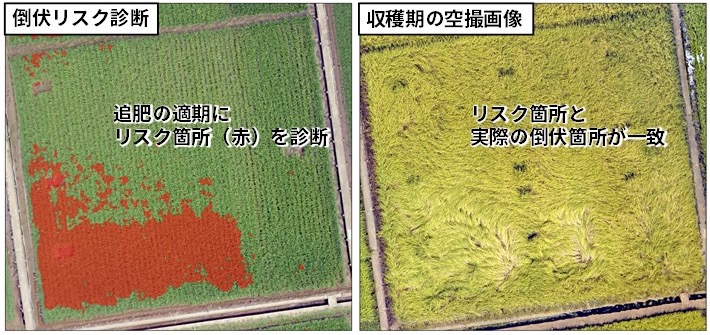
<Right image> Areal Image taken in a Harvest Season: The high-risk area and the actual lodging are matched.
The collapse risk assessment is quite accurate! Is there a situation wherein sensing could possibly help analyze taste?
Japanese people generally enjoy rice with a soft and chewy texture; thus, rice with these characteristics is highly valued. However, preference for certain food textures varies from person to person. Rice that feels “dry and bland” to one person may feel “light and quite palatable” to another, which means that taste preferences are quite different for different individuals.
The taste of rice is determined by factors such as the grain’s size, the moisture and protein content ratio, or the amylose-to-amylopectin ratio. I would like to convert information on these factors into objective data or numbers through remote sensing and create a “radar chart” out of it.
I heard that you are also involved in the brewing of Sake!
Sake is Japan’s flagship product made from rice. The rice used to brew Sake is not the same variety as that served and consumed in meals. Rather, a specific Sake rice is used to prepare this beverage. Among the Sake rice varieties, large-grain varieties with low protein content are preferred, such as Yamada-Nishiki. Since protein is a source of zatsumi, its bitter taste is often considered unfavorable for Sake. As protein is found near the surface of the rice grain, it is removed from the grain via polishing—a process known as milling. In the case of the Junmai-daiginjo variety of rice, more than half of the rice grain’s weight must be milled off, which ultimately reduces the overall utilization of the harvested rice.
However, in the case of rice with low protein content, it is possible to match the quality of Junmai-daiginjo without milling more than half of the grain’s weight. Therefore, I developed a model to estimate the protein content ratio based on the growth environment so that Sake rice could be utilized effectively without significant losses. Through this model, we are trying to optimize the milling ratio according to the protein content of the rice and develop a new Sake brewing technique that utilizes precious rice effectively. This research is being conducted in collaboration with the Izumihashi Sake Brewery from the Ebina City of Kanagawa Prefecture, which was founded in 1857. This brewery specializes in brewing Sake using locally grown rice varieties.
Telling the story of the land with terroir
Tell me about the future that you see for agriculture with this sensing technology
In a nutshell, I am aiming for agricultural practices that are more rewarding and attractive to the producers than they are now. There are various forms of rewarding agriculture, such as observing consumers find joy in consuming high-quality products or selling products that can fetch profits. I have always thought that remote sensing would become a “useful technology” for various aspects of future agriculture. One such form of agriculture that can utilize sensing technology is narrative-driven agriculture.
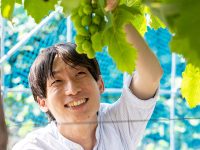
In the case of wine production, terroir—which refers to the characteristics of the natural environment that give the source grapes growing there a particular flavor profile—is an established concept. These include the climate, type of soil, amount of sunlight and precipitation, temperature range and fluctuations, topography, elevation, and wind direction, among others. While the list of such environmental factors is non-exhaustive, as a terroir, they all contribute to the “narrative” of wine production.
Terroir is applicable to all agricultural products that are affected in one way or another by the environment. For example, the characteristic of locally brewed Sake might be the zatsumi—the bitterflavors unique to a specific region. I wish to use sensing technology to scientifically quantify the characteristics of local crops and products and use them to appeal to potential consumers as original and unique traits. In fact, there are many people who prefer Sake that has zatsumi over Junmai-daiginjo. Using sensing technology in this manner will reward producers with satisfaction and increased income, which will contribute to the development of the industry as a whole.
Becoming a practice-oriented researcher
Drones were just becoming popular around the time I got into university. Sensors mounted on drones have now become smaller and more cost-effective, making sensing technology-based research for my projects easier and more feasible than before. Recently, I have been fascinated by the LiDAR sensor used in autonomous driving technology, which enables 3D measurements simply by walking around with the sensor in hand. In fact, this technology has also been used in some iPhones and iPads. I am looking forward to seeing what kind of technology will emerge in the future.
On the other hand, no matter how excellent technology is, if we do not know how to use it in the field, we will not benefit from it. There are multiple exciting ways to apply the wonderful state-of-the-art technologies developed by professors and researchers from the Faculty of Engineering. My role is to act as a bridge between technological development and the target users in the field.
Understanding what is going on in the field is vital to achieving this purpose. For example, we humans eventually determine the validity of data and set standards. To become researchers who can make accurate judgments based on what they observe, I personally believe it is important to go out into the field, interact with agricultural producers, observe the subject with one’s own eyes, sense the atmosphere, and cultivate one’s senses as well. In agriculture, as well as in other fields, the best theoretical answer is not always the best practical answer. While these words are by Professor Matsuoka, Dean of the Graduate School of Horticulture, I personally agree with it and love it. This gap between theory and reality is a challenging aspect in the field of human agriculture, and also an interesting one.
If you are a student who loves cutting-edge gadgets, food, and the outdoors in general, please come visit our laboratory. Let’s work together to boost Japan’s agricultural industry using the latest technology!
Series
Horticulture Innovation −Creating the Future of "Food" and "Greenery"−
Chiba University is the only national university that accommodates a department of horticulture in Japan. We highlight our researchers who are exploring the possibilities of Food and Landscape.
-
#1
2022.09.27
Fostering Global Well-being Through Horticultural Innovation
-
#2
2022.10.17
Making the Invisible Visible: Drones Enabling Agricultural Advances
-
#3
2022.11.07
Designing a world-class climate-resistant fruit!~Developing “Designed Grapes” for Custom-Made Wine to Commemorate Special Occasions
-
#4
2023.02.02
Towards a self-sustainable natural environment: The science of restoration ecology, where researchers engage in conversation with the earth
-
#5
2023.05.19
The reciprocity of life: The interactive relationships between people, plants, and the environment